Jason’s Weather Blog
If you’ve ever attended one of my weather presentations or read an article of mine, you know I rely heavily on Sea Surface Temperatures (SST) for long range weather forecasting. I do this because of the substantial influence SST’s have on the weather here in Montana. So, with that said the simple answer to the title of this article is we’re experiencing a change in the SST’s.
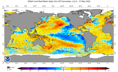
If we look back to a previous article I penciled up in May, we broke down the Pacific Decadal Oscillation (PDO) and how the SST’s in this region would impact the months of June and July. Here’s a snapshot of the SST’s from the month of May. You’ll notice the cooler than average SST’s just south of Alaska and along the Washington and Oregon coast. Ultimately it was this pocket of cooler water that helped low pressure troughs develop off the coast and bring much needed precipitation to the state.
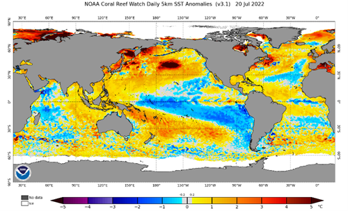
Now let’s look at where we’re sitting currently in the terms of SST’s. You’ll notice the colder than average pocket of water off the coast is no longer there. This tells us the SST’s are transitioning from a Negative PDO phase to a Positive PDO phase. You’ll also notice La Nina is still alive and well along the equator. To get an idea of what the next month or so has in store for us we’ll need to investigate the puzzle pieces we’ve been given. As a little disclaimer before we get into the puzzle pieces, very little is certain with weather and weather patterns. There are a ton of factors that play into the actual outcomes of weather patterns and this article breaks down my opinion of how these elements will affect our weather!
Since there has been little change with La Nina, the factors associated with this pattern will remain one of the driving forces of our weather over the few weeks. La Nina generally allows for a strong high-pressure ridge to build to our south, in the four corners region, which causes the desert southwest heat to move our way. This ridge also causes most of the moisture to track to the north of Montana.
The Conclusion…
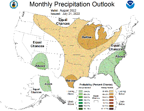
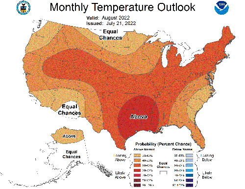
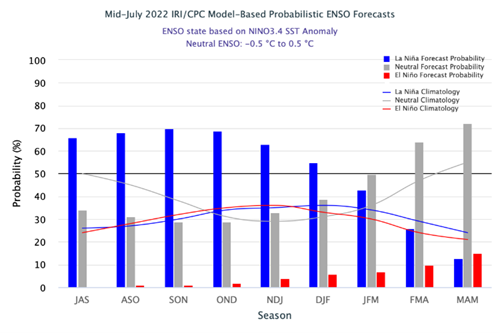
If you skipped to this point of the article without reading the prior content, shame on you, there’s some good stuff in there haha. The bottom line is, I’m expecting hot and dry conditions through harvest. Forecast models are suggesting the La Nina pattern will continue well into winter, which I have no reason to believe won’t be the case. Below this article you’ll find the National Weather Service outlooks for the month of August. I don’t always agree with their forecasts, but I feel they are spot on for August.
