Jason’s Weather Blog
For those of you who don’t know me, prior to the joining the Montana Wheat and Barley Committee I was a Television Meteorologist. Que the throwing of rotten fruit and insults! Along with meteorology I also reported on and covered agricultural news. So, with this said, I’ve kicked around the idea of writing up a weather blog for a few months now.

Before we get into this, please keep in mind I’m not a wizard, so predicting the future is still a bit tricky. The goal of this article is to provide you with a few of the puzzle pieces that go into long range forecasting and to give you “my” interpretation as to what they could impact our weather. Use this forecast at your own discretion, because after all everything in weather has a 50/50 chance anyway, right?
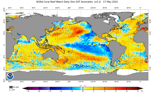
To understand or at least have some sort of an idea as to what the next month’s weather forecast is looking like, we must examine the sea surface temperatures. Currently we’re still in a strong La Nina pattern which is indicated by the blue color in the South Pacific Ocean on the picture below. The sea surface temperature fluctuations in this region are called the El Nino-Southern Oscillation (ENSO). The La Nina pattern we’re currently in generally leads to wetter conditions in the Pacific Northwest and somewhat dry and windy conditions for much of Montana. Forecast models are suggesting that the La Nina pattern will stick with us through the summer and given its recent amplification I tend to believe this.

The area I’m more interested in is the Pacific Decadal Oscillation (PDO) region, which is located just south of the Gulf of Alaska and adjacent to the Pacific coast. The sea surface temperatures (SST) in this region are cooler than average and have been this way for quite some time. These cooler SST’S are one of the factors that played into the slightly wetter winter this last season compared to the 2020-2021 winter season. I’m not certain as to whether this cooler water will remain planted here but given the intensity and consistency of the negative PDO over the past few months, nothing is telling me that it won’t stay in place.
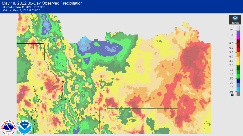
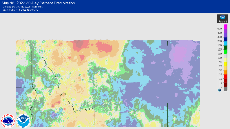
Now let’s factor in the jet stream and global circulation patterns. Recently we’ve had strong onshore flow from the Pacific Ocean which has helped to draw some moisture through the state. Given the placement of the jet stream, the most prominent moisture flow has been through Southern Montana and then back up into the Dakotas. As long as no major influencers move in such as a strong high-pressure ridge, this pattern will likely continue and bring with it more much needed moisture. Please keep in mind that this likely won’t be enough to break us out of a drought but should be enough to help with growing conditions for most of the state.

So, does this all mean? Well, generally I’d be more concerned with a strong La Nina pattern heading into the summer months as it can lead to high pressure blocking, in other words a hot and dry summer like last year. But as I mentioned earlier, the negative PDO off the Pacific coast will help to regulate the more extreme impacts of La Nina. Given this information I feel we’ll see overall temperatures at or just below average and somewhat consistent showers for the majority of Montana during the month of June. Having this pocket of cold water off the coast does aid with low pressure trough development in the Pacific Northwest. This basically means we’ll have a better chance for rainstorms as moisture is drawn our way from the Pacific. I’m not confident that these showers will impact the Hi-Line as much as Southcentral Montana given the recent storm paths through the state.
If you get nothing else from this article, I hope that you were able to pick up on a few of the factors at play when it comes to long range forecasting.
